About Dataset
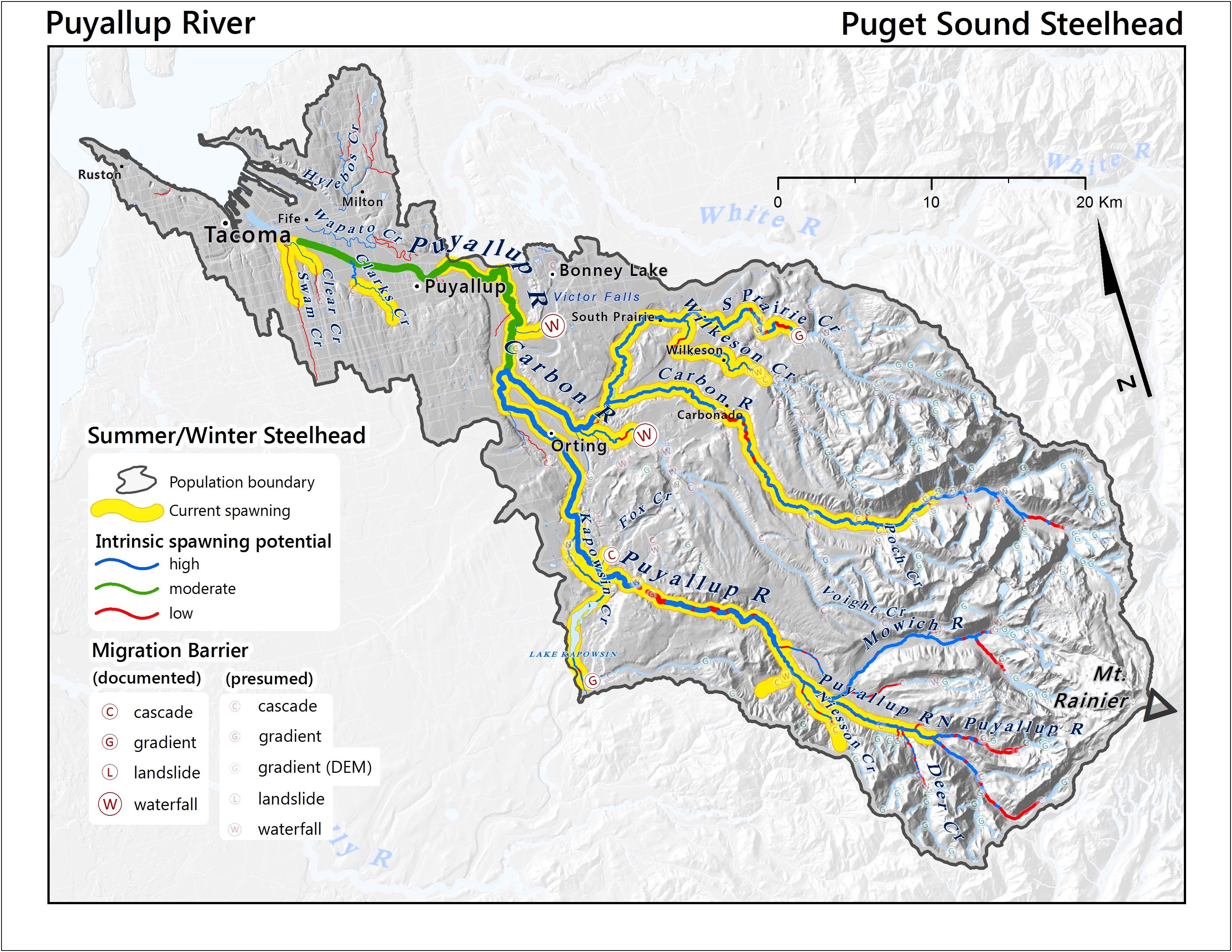
Built using 1:100k, NHD Hydrography We developed a reach level intrinsic potential (IP) analysis for application to steelhead spawning reaches for assessing habitat quality within currently and historically occupied portions of the Puget Sound steelhead DPS. This approach enabled us to formulate a baseline perspective from which we could assess contemporary changes to productivity. Utilizing established relationships between habitat type, stream structure, landscape processes, and spawning use, we built a locally adapted Geographic Information System (GIS) based model. The GIS was used for the development, presentation, management and modeling of spatially referenced data. Geomorphological characteristics were assigned to unique categories of gradient and width and these classes were given IP scores that reflect relative steelhead spawning preferences based on observed densities within those habitat characteristics. Additionally, we identified natural stream blockages and scored reaches above waterfalls, cascades, and DEM calculated gradients with zero spawning potential.
Source Type | Description | Upload Date | Data File/Connection | EditDelete |
|---|---|---|---|---|
| File | This compressed file contains a shapefile describing intrinsic potential habitat for listed steelhead within the Puget Sound DPS | 9/29/2025 |
Showing 1 to 1 of 1 Data
Coverage Areas (1)
Contact Name | Title | Agency | Email | EditDelete |
|---|---|---|---|---|
| Damon Holzer | Project Manager | NOAA Fisheries | damon.holzer@noaa.gov |
Showing 1 to 1 of 1 Data
Title | Ecosystem | Last Updated | Version | Contact Names | EditDelete |
|---|---|---|---|---|---|
| No data found!! | |||||